Historical Photos
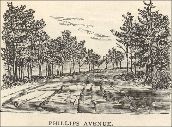 1873 lithograph of Phillips Ave., at what appears to be the northern corner, just before the road turns east along Hoop Pole Cove. This would be at the bottom of the long hill that runs along the western edge of Andrews Woods; the deep ruts in the road are probably due to spring runoff. An advertisement for the 1870s "Ocean View" development would boast that "The Avenues are fifty feet in width, and are built in the most thorough manner, being covered with disintegrated granite or gravel, making a beautiful and smooth road, which is always dry and free from mud or dust the year round." Later photos do show smoother surfaces, at least in the summer. Seasonal flows through the woods still bubble up at this location, forming a stream along the side of the road.
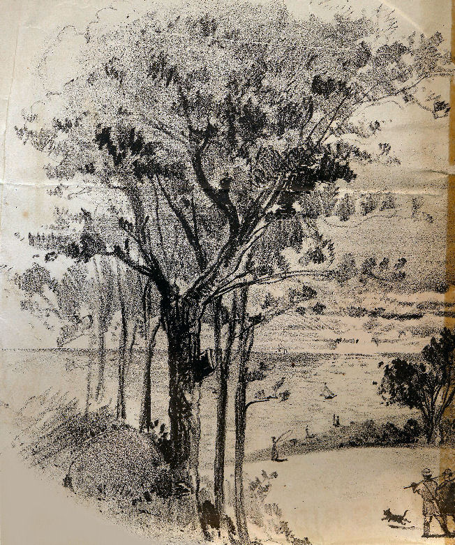 Advertisement for the 1870s "Ocean View" development, showing what may be the same corner as in the lithograph above. Notice that dog walking was already being depicted as a popular pastime around Andrews Woods.
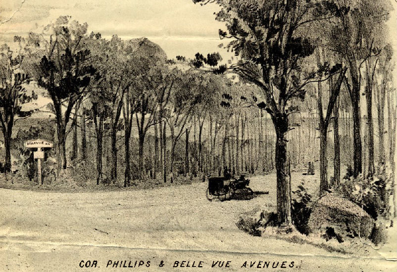 Advertisement for the 1870s "Ocean View" development, showing the corner of Phillips Ave. and the never-constructed "Bellevue Ave." (called "Sacramento Ave." in later development plans). The avenue was intended to go from the souteastern side of Phillips Ave. below Point de Chene Ave., across to Haven Avenue, through Andrews Woods, and then connect with Woodside Ave. at the northern end of the woods. The southeast section between Phillips and Haven Aves. is still maintained as a public footpath by the Rockport Rights of Way Committee.
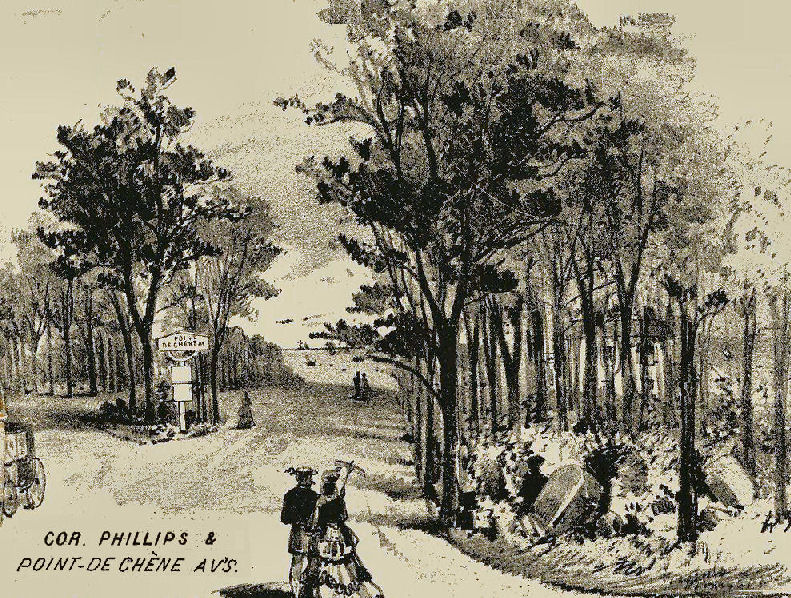 Advertisement for the 1870s "Ocean View" development, showing the corner of Phillips Ave. and Point de Chene Ave. The triangle in the Y of the roads is still there, maintained as a public flower bed.
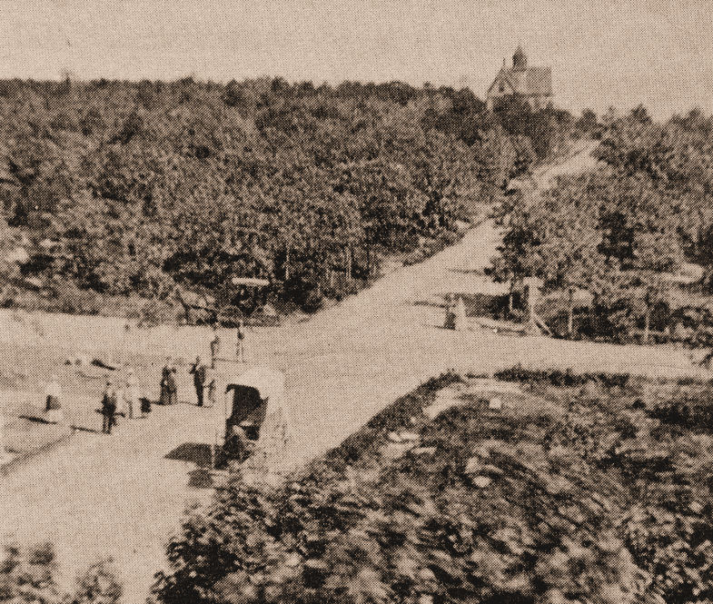 Corner of Haven and Ocean Aves., circa 1879, looking north into Andrews Woods. Haven Ave. runs NE to the top of the photo, with the large cottage of Mrs. Corinna Bishop on the left. This is before much of the area began to fill with summer cottages.
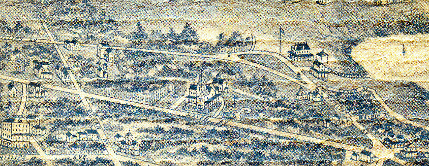 1886 lithograph showing the northern end of Pigeon Cove, with Hoop Pole Cove to the right. Andrews Woods surrounds the large cottage of Mrs. Corinna Bishop on Haven Ave. Spring water "refreshment stands" are visible at either end of Woodside Ave., which runs diagonally along the northern edge of the woods. The large "Meadowcliff" cottage of Mr. John Stowell is at the northern corner of Phillips Ave., adjacent to the Andrews Hollow "meadow" and the "cliff" above Hoop Pole Cove. The home of Mr. Eben Phillips is at the lower right, just below the intersection of Haven and Phillips Aves. Phillips was the developer responsible for laying out "the Avenues" of his ambitious "Ocean View" development plan. The Ocean View House, a popular summer hotel built in 1871, is at the lower left.
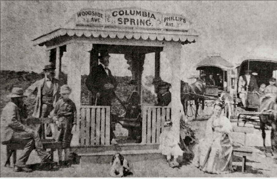 Columbia Spring, one of two such "refreshment stands" at the intersections of Phillips and Woodside Aves. The "mineral spirits" of these springs were advertised as one of the attractions of the "Ocean View" development. This appears to be the NE stand, where a rocky hole in the ground still marks its location. The SW stand was adjacent to what is now a vernal pool in Andrews Woods, where a seasonal "spring" continues to bubble up and flow down the hill along the side of Phillips Ave. Woodside Ave. is now a path along the northern edge of the woods.
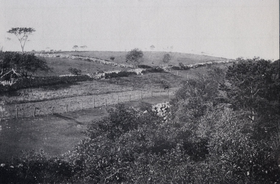 A view of the side of Pigeon Hill at the end of the 19th century. Although Pigeon Hill is at the southern end of Pigeon Cove, and Andrews Woods is at the northern end, the extensive stone walls separating pastures and orchards are similar to those found running through Andrews Woods.
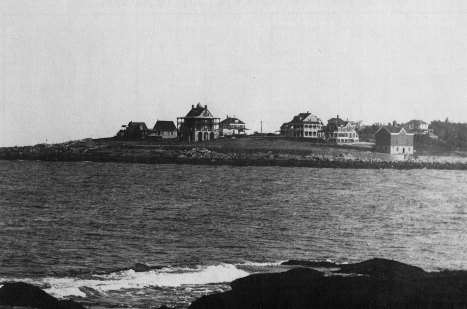 A view looking east across Hoop Pole Cove, showing the "Ocean View" development on Andrews Point at the end of the 19th century. The large cottage left of center is the "onion top" cottage of Mr. John Way of New York. The barn at the lower right was on the Way property; its foundation is still in place on the Atlantic Path just below Long Branch Ave.
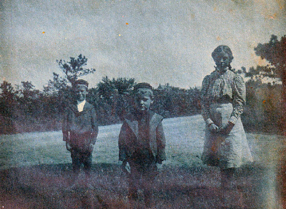 Corner of Phillips and Haven, with the "onion top" cottage on Andrews Point in the background. Late 1800s.
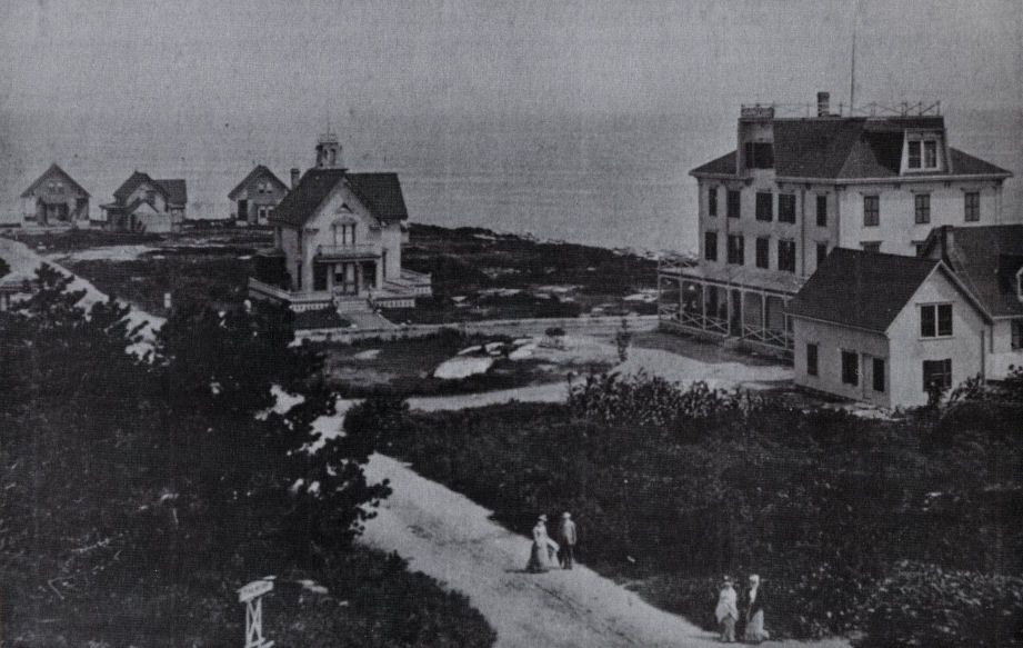 Point de Chene Ave. on Andrews Point, showing the Linwood Hotel at right and surrounding cottages. The corner with Long Branch Ave. is at the upper left. The Linwood, a popular summer hotel of the "Ocean View" development, was built in 1877. A description in the Cape Ann Advertiser that same year said "The location is peculiar: so very near the dashing surf that the coming summer boarder can sit on the broad veranda and toss a pebble into the waves." The hotel burned in 1906.
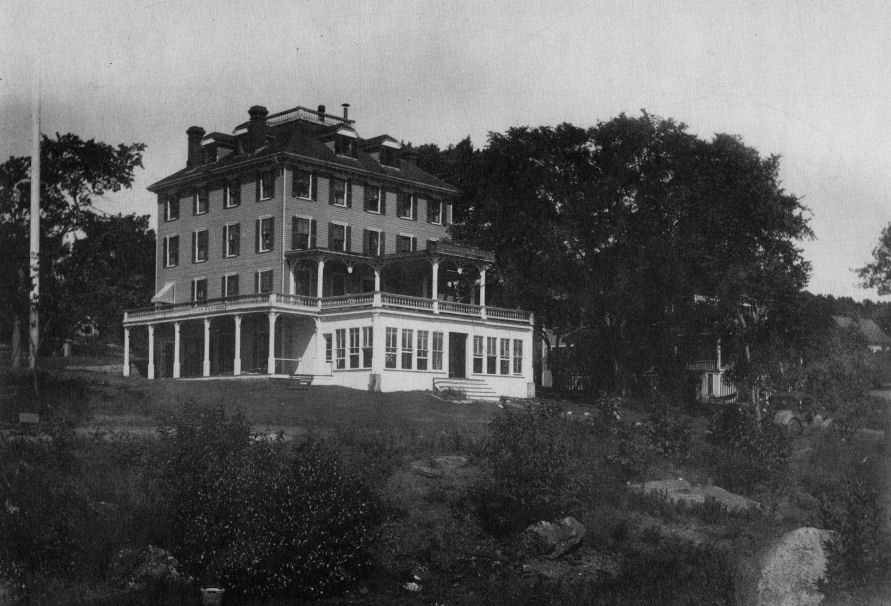 The Ocean View House, Eban Phillips' original hotel for the "Ocean View" development, at the corner of Phillips and Mt. Locust Aves. The hotel was built in 1871. The "Ocean View Polka" became a best-selling piano piece at the time, singing of "the roar of the waves and the dash of the surf." The hotel operated for more than sixty years, and was finally torn down in the 1940s. It was one of the few hotels of the "Ocean View" development not to burn.
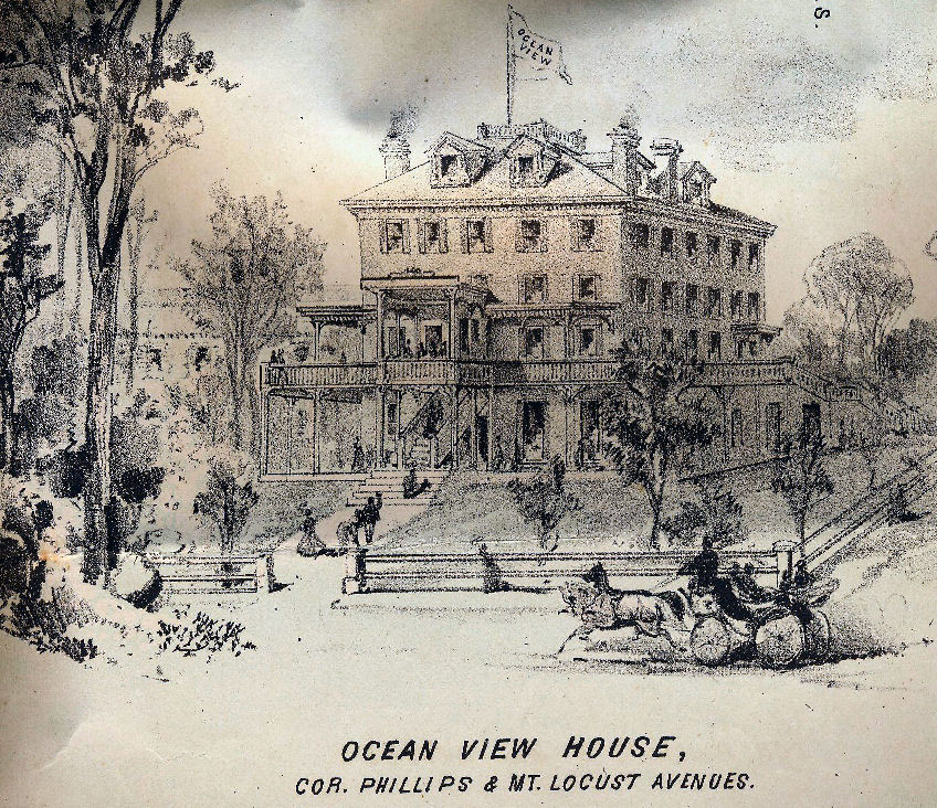 The Ocean View House, from an advertisement for the "Ocean View" development.
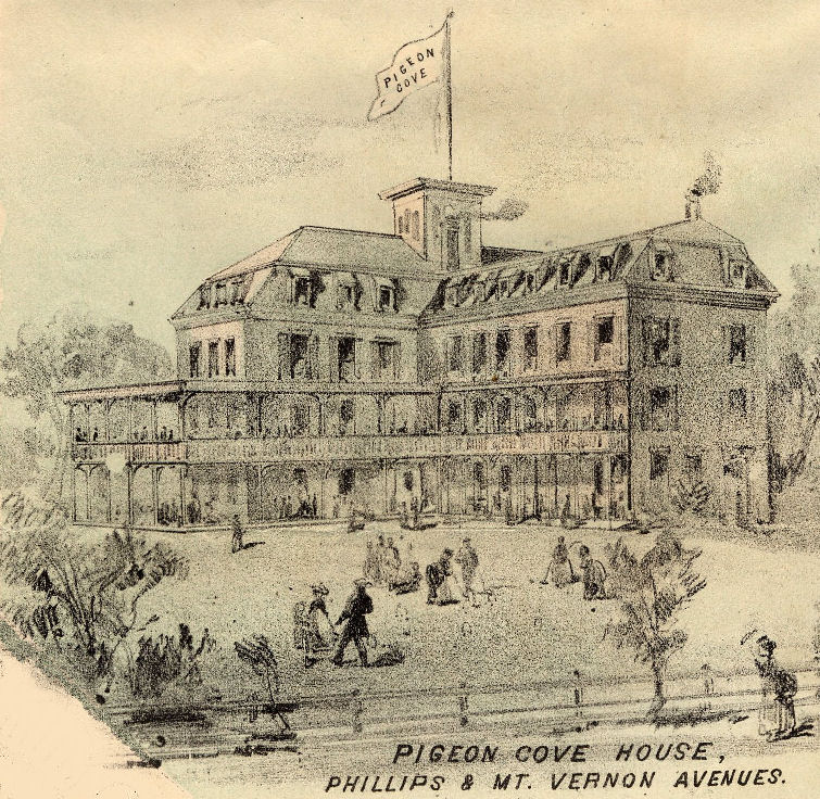 The Pigeon Cove House, from an advertisement for the "Ocean View" development. This was another popular summer hotel of the "Ocean View" development. The hotel was located between Phillips Ave. and "Mt. Vernon Ave." (the carriage road that is now Granite St.), at the place where Phillips Ave. now intersects Lacrosse Ave. This was the second Pigeon Cove house; the original was moved down the street in 1871 and became what is now the Emerson Inn.
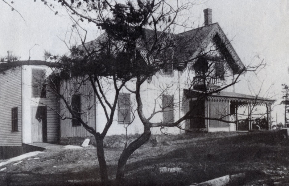 The first summer cottage on Andrews Point, built for Lyman Taft of Worcester, on Point de Chene Ave.
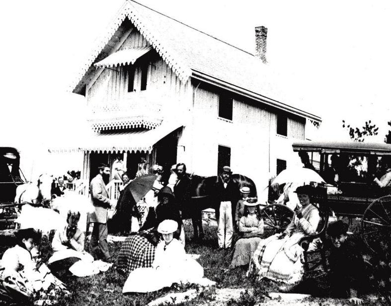 The Bellevue cottage, typical of the smaller summer cottages of "Ocean View."
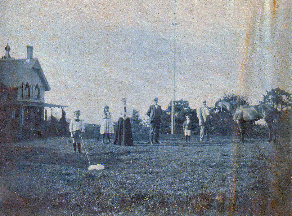 Another summer cottage of "Ocean View."